Winter Weather Advisory issued for DC region, icy roads expected ahead
Freezing rain, wintry mix expected across Maryland, Virginia
Freezing rain and a wintry mix expected across Maryland and Virginia could make holiday travel difficult Tuesday. FOX 5 meteorologist Mike Thomas delivers the forecast.
Winter Weather Advisory issued for some parts of DC region
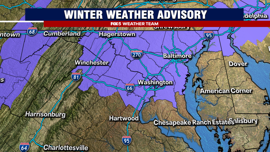
For the first time this season, and first since February 16, the D.C. metro region finds itself under a Winter Weather Advisory.
With this being issued just before the Christmas holiday, does that mean that D.C. could finally end up with a white Christmas? Unfortunately, no.
These advisories were not issued because of snow, but instead for the threat of some light icing across the D.C. region.
Below freezing temperatures
It's another cold front that is responsible, similar to the one that brought snow showers and flurries to the D.C. region on Friday.
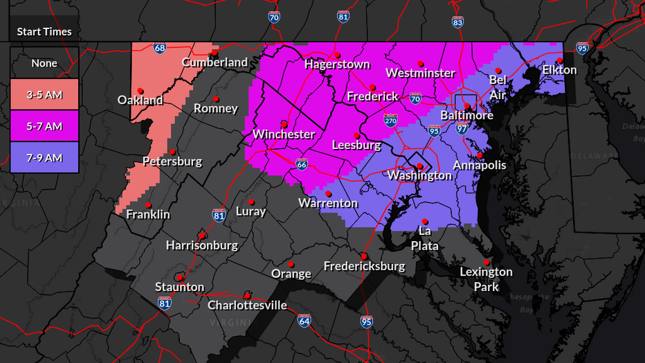
Temperatures are expected to be below freezing through most of the morning tomorrow as precipitation pushes into the D.C. region. Areas to the northwest could see some snow showers or flurries kick things off (a scattered, light coating of snow is possible in some of these areas) between about 5-7am. As we approach sunrise, precipitation is expected to approach the immediate DC metro region, between about 7-9am. At the same time, warmer air will be starting to push into our region in the lower atmosphere, warming the air above our heads above freezing while at the surface, we stay below freezing. This process melts snowflakes at they fall, forming small raindrops, but because the temperatures at the surface stay below freezing, they are able to refreeze quickly once they hit the surface.
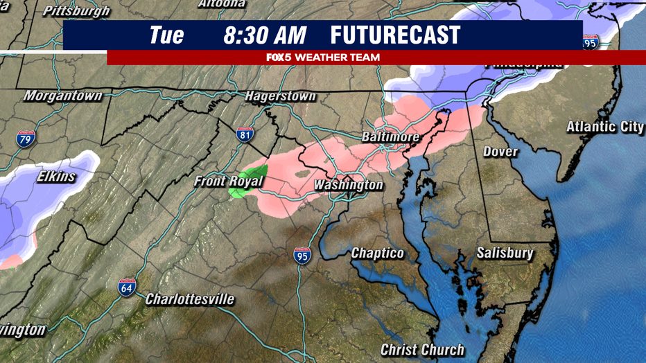
The issue with ice is that you really do not need much of it to cause major problems. If you are walking or driving in it, freezing rain falls just like regular rain. It does not give any warning that it will freeze once it hits the surface. It is also much harder to spot on the roadways than say, snow for example. The lightness of the rain could also play a role. Light freezing rain and drizzle accretes better than a heavier or steadier freezing rain because you do not have issues with runoff, and the cold air tends to take longer to warm above freezing when it is lighter.
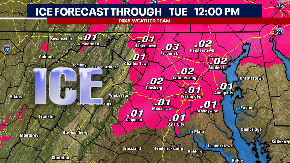
The key is in the temperatures, which are expected to remain at or below freezing for much of the D.C. region until about lunchtime tomorrow. So our recommendation is simple. If you do not have to be on the road early tomorrow morning, please stay home and wait it out. Road conditions should vastly improve by the afternoon hours as temperatures rise above the freezing mark. This is not an event that is expected to have lasting impacts either, as temperatures on Christmas Day are expected to rise above freezing.
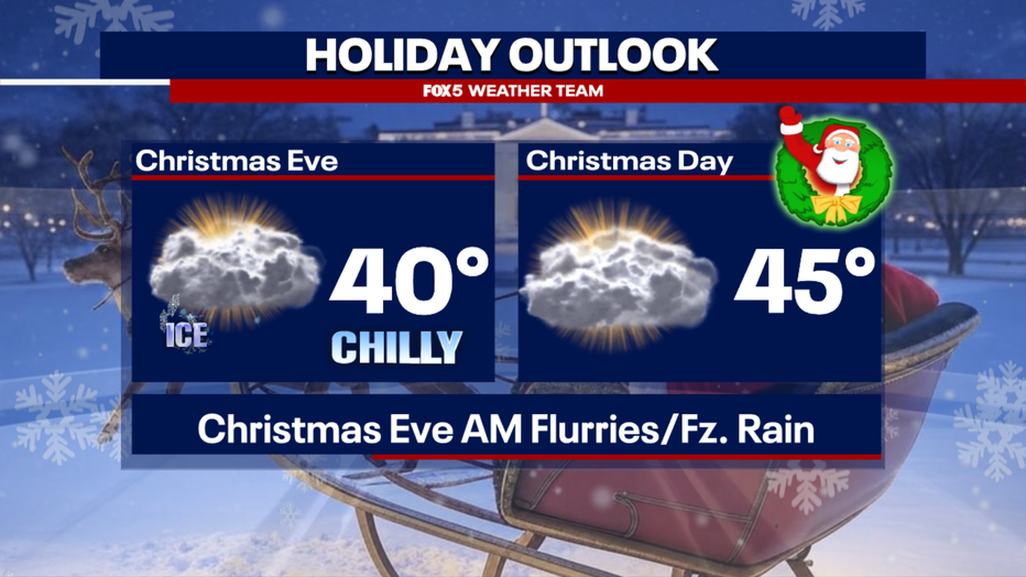
DC Christmas Day forecast
Christmas Day around the D.C. region is expected to be dry. We will likely see some sunshine filtering through some cloud cover in the afternoon, but don't expect fully blue skies.
A high of 45° is only a couple degrees below the season average, but will still be considerably cooler than it was last Christmas here in the D.C. region when we hit 61°F.
The remainder of the week beyond the holiday does look chilly, but dry, at least until the weekend, when the threat of some rain returns to the forecast.
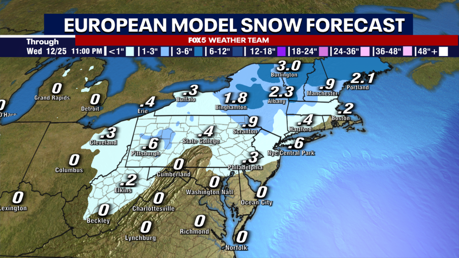
How close was DC to a white Christmas?
Considering the big picture, D.C. actually was not that far from a white Christmas! The same system that could bring us some freezing rain on Tuesday morning is likely to drop several inches of snow across upstate New York and interior portions of New England.
It will likely remain cold enough through Christmas Day in these places that some snow will remain on the ground. D.C. will tack on another Christmas without snow.
When was the last time DC saw snow on Christmas?
D.C. last had snow on the ground during Christmas Day in December 2009 (over half a foot!) but has not seen measurable snow falling on Christmas Day since 2002 (0.2").

