

Strong thunderstorms could bring risk for tornadoes to DMV this week

Severe thunderstorms could bring slight risk of tornadoes to DMV
A severe weather threat in the south is expected to expand into the D.C. region on Wednesday, bringing with it a slight tornado risk. The system will approach from the west, bringing the threat of gusty winds, thunderstorms and tornado activity.
WASHINGTON - Winter has officially come to an end as far as meteorologists are concerned. Despite spring not – officially – starting until March 20, meteorological winter ended on March 1.
In terms of numbers, winter closed out nearly a degree below normal (-0.7°F below normal) which may not seem like much but was enough for our coldest winter in a decade here in D.C. Snowfall also came in just over an inch above average – solid winter for snow-lovers.
Spring often means more wind energy atmospherically. Winter cold is generally retreating but occasionally fights its way southward into the United States.
At the same time, the tropics are beginning to warm faster as the sun angle continues to rise.
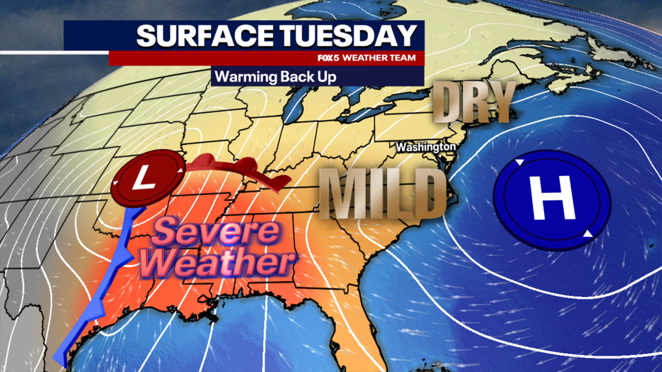
These temperature shifts lead to stronger jetstream winds, which can power powerful storm systems and lead to severe weather outbreaks. One of these storms will be developing in the middle of the country on Tuesday.
Storm Develops Tuesday
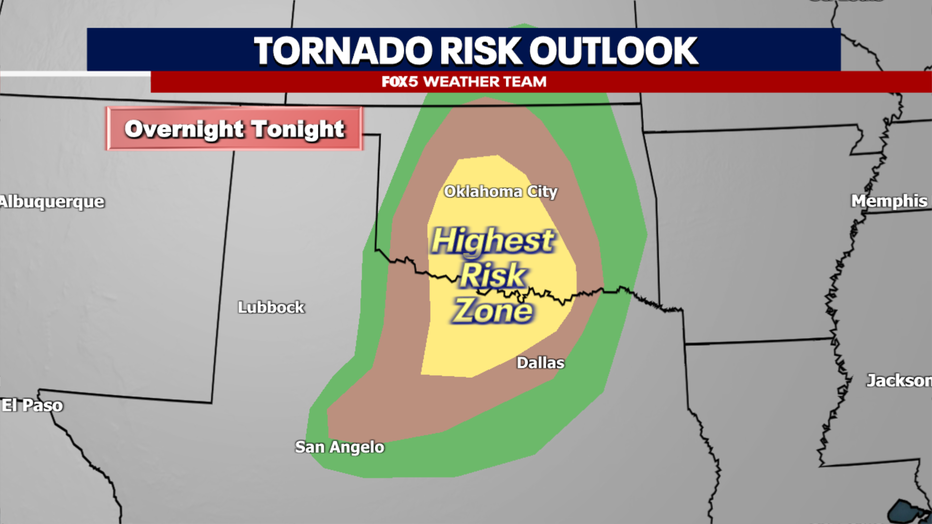
It begins as early as the overnight hours on Monday when storms could really fire across parts of Kansas, Oklahoma and northern Texas.
With high moisture coming off the Gulf clashing with considerably cooler and drier air wrapping around the system, coupled with an intensifying stream of strong low-level winds in the region...you have a recipe for strong to severe thunderstorms that could produce tornadoes during the overnight hours.
As the system continues to intensify through the day on Tuesday, the threat of severe weather and tornadoes will push eastward. Louisiana and Mississippi in particular are areas under the highest concern from the Storm Prediction Center.
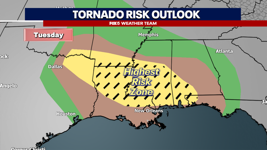
The dashes in the image above outline the region where forecasters are most concerned that EF-2 or greater tornadoes will be possible given the wind field.
Moving East Through Wednesday
The threat continues to push eastward into the day on Wednesday, including much of the Southeast and Mid-Atlantic. The D.C. and Baltimore region are currently under a "slight risk" with the greatest potential for some damaging wind with storms on Wednesday afternoon.
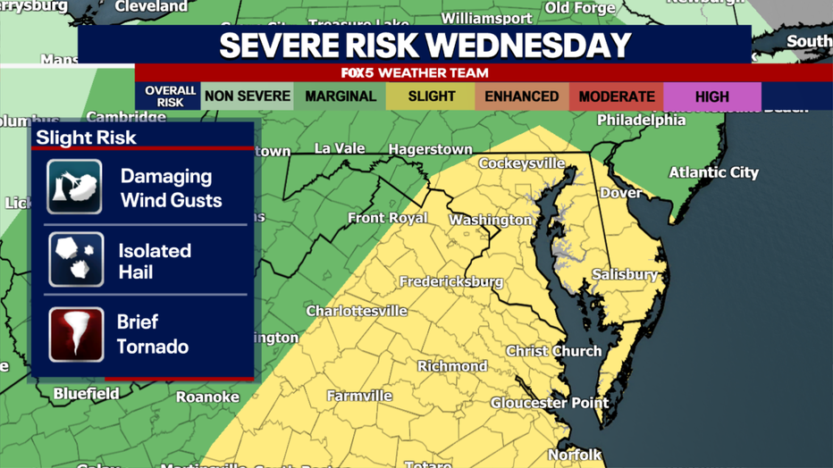
While not as big a concern as what our friends to the south will be experiencing on Tuesday, the threat is there for some isolated tornadoes to spin up ahead or along of the main line on Wednesday afternoon and evening.
We will be monitoring this closely in the days ahead. Winds could be quite gusty as the storm passes our region as well, especially Wednesday night into Thursday.
Looking Ahead
Behind the storm system, temperatures will dip on Thursday and Friday. You may have seen some social media chatter about a potential winter storm this weekend.
There is a single model (the American Model) which is suggesting that winter weather could be possible in the Northeast this weekend. However, as of Monday afternoon, it stands essentially alone in this solution. Most other models, including the European model, and
The AI enhanced European and American models suggest that this system will not threaten out area with any winter weather. We will keep an eye on it out of precaution, however, and let you know if there are any changes to this line of thinking.
Springing Ahead
As spring continues to draw near, warmer temperatures are inevitable. D.C.’s average high temperature by April 1 is 62°F, which is 10°F warmer than it is at the start of March.
That being said, our region is prone to occasional swings back to winter-like temperatures right through the first half of April from time to time. An early indication that we may be in for more temperature swings later in the month is a feature known as a Sudden Stratospheric Warming event, or SSW for short.
These events have been seen to be precursors to weather patterns over the Arctic region that push cold air southward, promoting periods of colder weather even into early to middle spring.
One of these events is forecast for the stratosphere over the North Pole through the first half of the month, which suggests that another push of colder air cold be waiting later in March.
We will continue to keep you updated with the forecast and any severe weather alerts through the course of this week.