

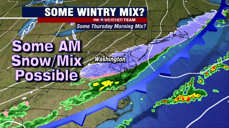
Snow, wintry mix possible Thursday could impact morning commute
FOX 5 Weather forecast for Tuesday, January 18
Mike Thomas has the FOX 5 Weather forecast for Tuesday, January 18
WASHINGTON - A cold and snowy pattern continues across the D.C. area this week as we keep an eye on two possible snow chances that could impact us -- the first Thursday morning and a second over the weekend.
SNOW CLOSINGS, DELAYS AND VIRTUAL ANNOUNCEMENTS FOR TUESDAY, JANUARY 18
Download the FOX 5 Weather App
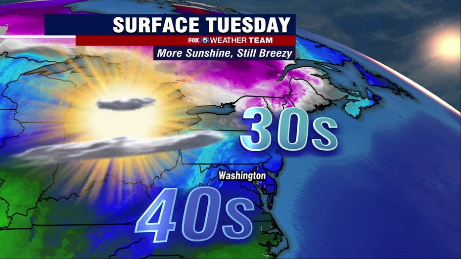
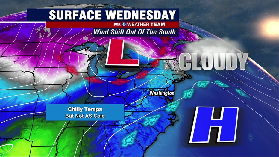
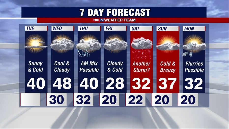
FOX 5's Mike Thomas says we can expect a cold, breezy and chilly beginning and middle of the week with temperatures around 40 degrees Tuesday and near 50 degrees Wednesday.
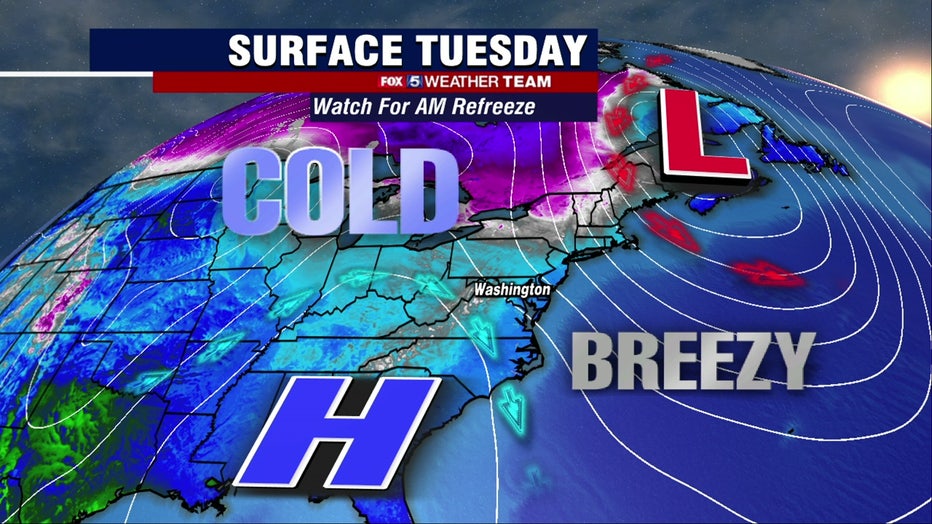
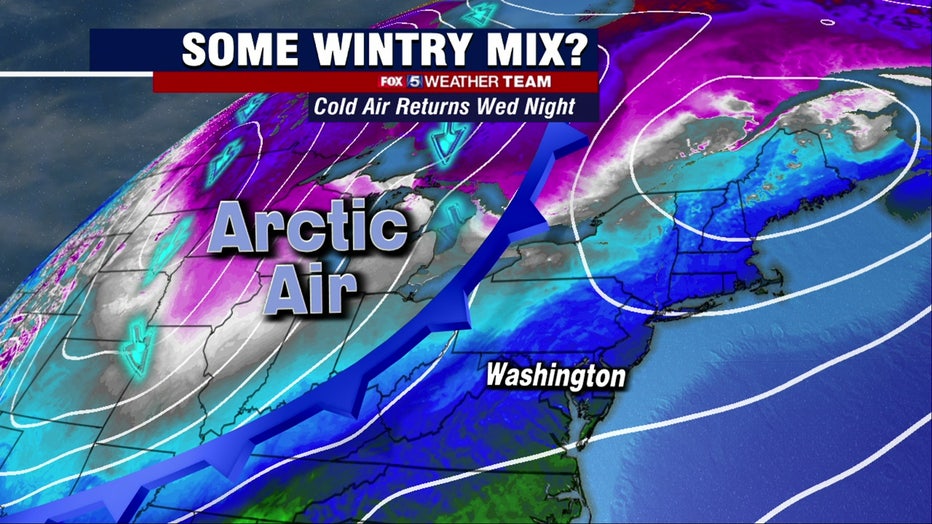
As even colder arctic air moves into the region Wednesday night -- so do the chances for more snow. Mike says winter weather could begin as rain overnight, switch to a wintry mix and end as a light but accumulating snow at the wrong time -- during the morning rush Thursday. Be prepared for possible school delays and a slippery commute during the morning Thursday as the precipitation moves through.
A second threat for possible winter weather returns in time for the weekend. Temperatures drop into the 20s Friday and a second snow chance moves into the region by the evening hours Friday night into the morning hours Saturday. Mike says this system could move up the coast and could possibly bring some accumulation to the D.C. region.
We're still several days away from both systems -- stay with the FOX 5 Weather Team for the latest forecast updates!
Stay with FOX 5 on the app and online for weather updates:
Get the latest FOX 5 forecast here.
Check the latest Closings and Delays
Download the FOX 5 DC News App for Local Breaking News and Weather
Download the FOX 5 Weather App
Check the latest weather radars
Stay up to date with the FOX 5 Weather Team on Twitter: