Snow showers may impact Thursday morning commute

Bundle up! Cold continues for DMV with frigid temps Wednesday
It's going to be another chilly day in the DMV so bundle up in the morning! FOX 5's Mike Thomas has your full evening forecast.
WASHINGTON - After the warmest November on record, December has started on quite the opposite note. In fact, this has so far been the coldest start to December in 19 years, since 2005.
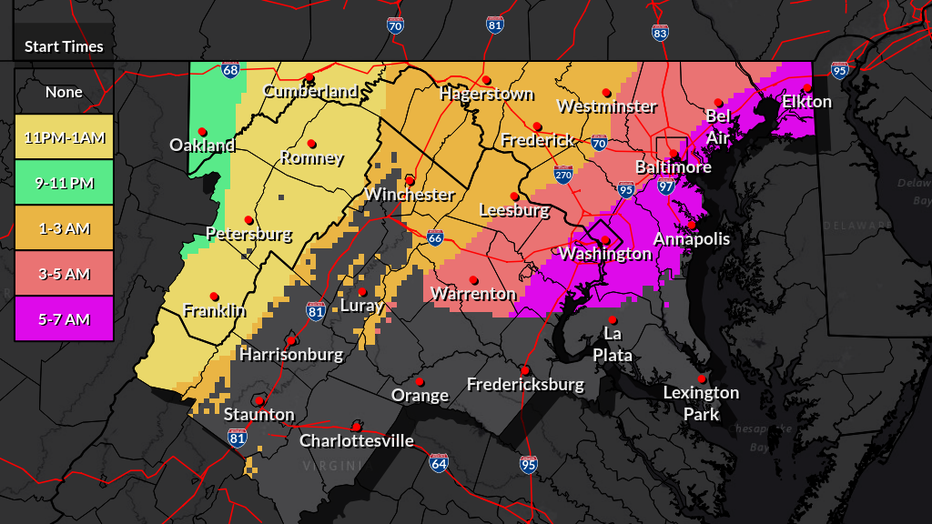
With it, we have had the occasional snow flurry come across the D.C. region in the last week, but Thursday morning there is the threat that parts of the region pick up a quick coating as a fast moving system sweeps across the Northeast.
READ MORE: Frigid temperatures, gusty winds move into DC area; region braces for wintry mix Thursday

Clippers are waves of low pressure that originate in Northwest Canada and ride the jetstream southward towards the eastern half of the United States.
They are typically moisture starved as they do not have a warm body of water nearby to draw in substantial moisture from.
However, they have an advantage that they typically exist within an air mass that is already cold enough to support snow. While marginal, this is generally the case with the event on Thursday morning.

Source: National Weather Service
Thursday's forecast is a tricky one, not in that we are expecting a lot of snow, but in the type of snow we are expecting. We are mostly expecting run-of-the-mill snow showers and snow flurries that are not substantial.
There is a touch of warmer air mixed into the upper-levels as well, especially around I-95 and areas to the east, that could lead to some mixing with the snowfall as well. However, another threat we are certainly watching is for what we call a snow squall.
A snow squall is a brief, but often intense period of snowfall can reduce visibilities to hazardous levels, and even lead to minor but quick accumulations. Sometimes called "mini blizzards", they typically last no more than 20-30 minutes, though can lead to near whiteout conditions and quickly turn cold roadways hazardous.
They are typically located around strong fronts, gusty winds drop temperatures quickly in their wake. They tend not to be widespread though, and typically only cause these extreme conditions on a localized basis.

Indeed, not much snow is expected at all. The National Weather Service is only alerting for a "scattered coating" and most weather models agree.
In fact, the entire window of concern for these snow showers and squalls around the DC region is just in a very short window between about 5-8 a.m. on Thursday morning.
Some sunshine should return as early as the late morning hours. The only major concern is the timing, with that being centered through the bulk of the morning commute.
While squalls are not a guarantee, should one occur during the morning rush near the beltway, things could get tricky fast. Just something to keep in mind for your Thursday morning commute, you may want to leave some extra time just in case!
As the nature of snow squalls is more hit-and-miss, it is highly unlikely that school systems would delay or cancel. Even if a squall did happen to come across, the snow it would leave behind would not be much at all, and would likely be gone by lunchtime.

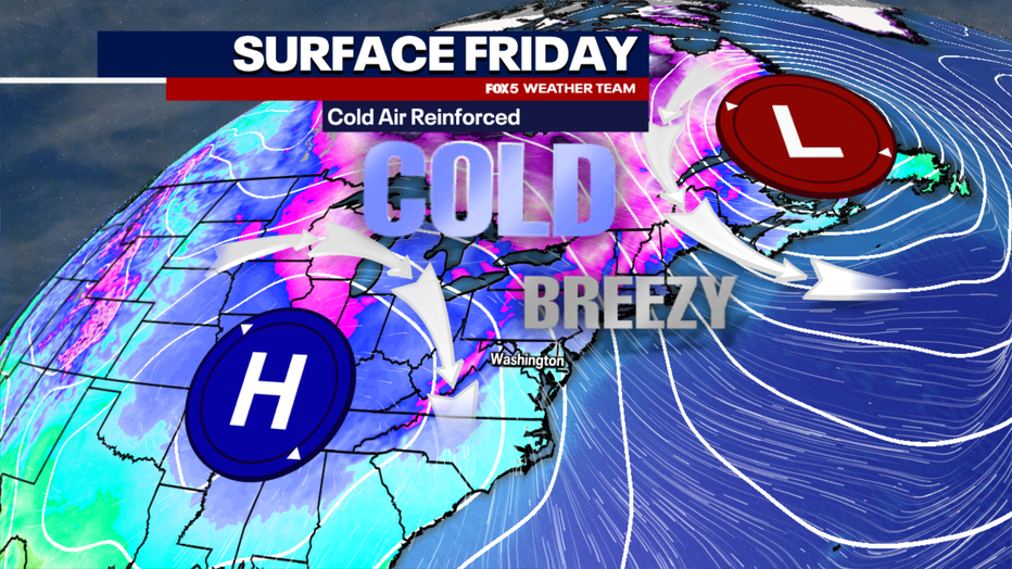
Behind this arctic boundary moving through on Thursday morning awaits some of the coldest air of this particular outbreak. Winds could gust in excess of 45 mph on Thursday afternoon as temperatures tumble.
Wind advisories are possible for much of our region as a result. Wind chills could quickly drop into the teens and 20s, perhaps even colder by Thursday night. Friday could be the coldest day of this entire cold wave that we are in, as many will not make it out of the 30s on Friday afternoon.
We may be just under three weeks from the Winter Solstice, but have you had enough of this winter cold already? Well, there is a very good chance that we may break this cycle of cold by the end of the weekend.
Computer models have been trending in the warmer direction for the front half of next workweek. Many suggest that the lower to middle 60s is going to be possible by next Tuesday, though this may come with some rainfall.
Beyond that, the pattern suggests one of relative back-and-forth, shorter periods of chilly temperatures with some milder days mixed in as well, but nothing sustained to the level of this week. There is no strong chance for any snow of significance in the foreseeable future at this time either.

