Cherry blossom peak bloom is near! Here are the best days to see the blossoms this week
WASHINGTON - With Spring now upon us, people around the D.C. region area without a doubt eager to enjoy all that spring has to offer around town.
Perhaps nothing in our region stands as quite the symbol of the season as much as the cherry blossoms around the Tidal Basin downtown. It is estimated that nearly 1.5 million people visit the city's famous trees each year.
DC’s cherry blossoms near peak bloom
D.C.’s cherry blossoms are nearing peak bloom and FOX 5’s Bob Barnard is checking out the conditions at the Tidal Basin in case you want to take in the beauty – but suffer from allergies!
With the blossoms officially reaching stage 5 on March 18th, peak bloom is likely within the next couple of days. But which will be best to see the blossoms weather wise?
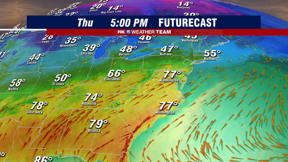
Well, if you are a fan of warm temperatures, you just might want to go on Thursday. Many weather models project it to be the second-warmest day of the year so far, since we hit 81° back on February 23rd. Middle 70s will feel nice, but a warning that the morning hours are not expected to be the greatest.
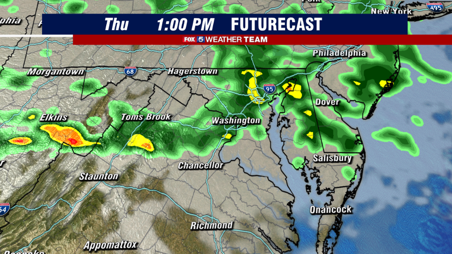
A warm front crossing our region from the south is likely to scatter some showers across the region throughout the morning hours and into the early afternoon.
Beyond that point, it is all about whether or not we are able to break into sunshine in the afternoon for how warm we will become. If we turn mostly sunny before the 3pm hour, we could easily see temperatures climb to near 80°F by late afternoon. If we hold onto more cloud cover into the early evening, lower 70s are more favored. Regardless of which ends of being correct, this will in all likelihood be the warmest day of the week.
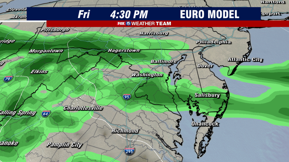
On our tracker, there is only one day that get the "red" day, that may be a good one to pass up if you want to be comfortable at the Tidal Basin. That day is Friday.
The same front that brings the warmth on Friday will turn around and push southward on Friday. Clouds are expected to overspread the region with drizzle and showers throughout the day.
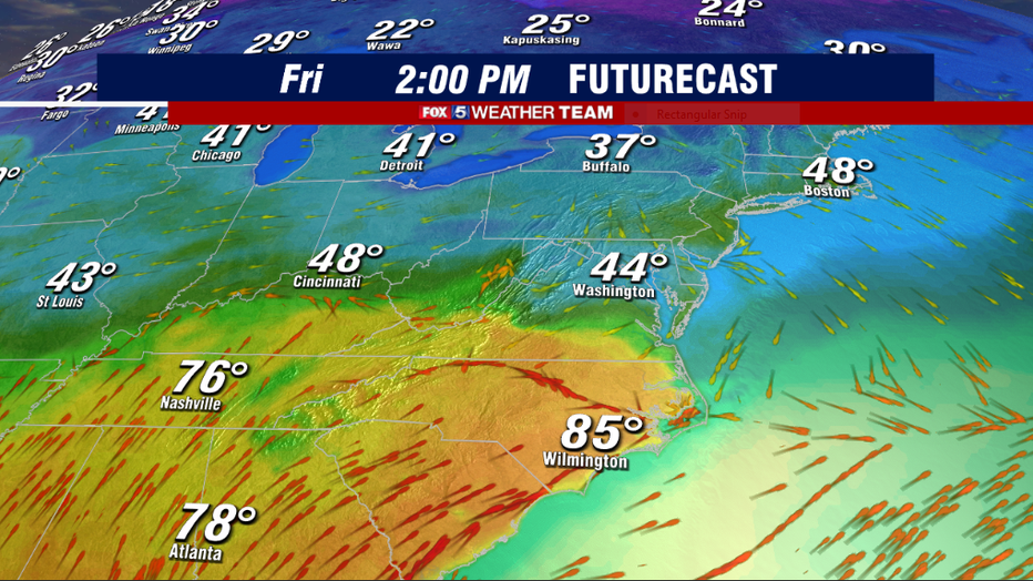
In addition, winds shifting out of the north behind the front will push the warmth from Thursday down into the Carolinas. These winds will likely hold temperatures in the 40s or lower 50s much of Friday afternoon in the region.
Combined with the clouds and the showers, it just is not looking like a very nice day. Friday is the one day through the weekend that does have "washout" potential.
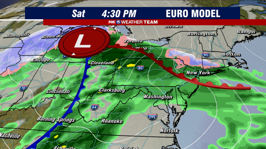
By Saturday, a storm system pushing up through the Midwest should shift winds out of the south once again. Highs should return to the 60s. While it does not look like a washout, expect scattered rain showers in the area. Winds will likely be a bit gusty as well, though not enough to damage the blossoms.
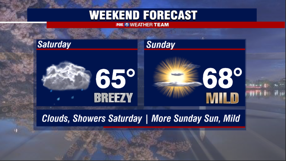
The pick of the entire weekend will likely be Sunday! Sunshine should return to the region, and while we could continue to be a little bit breezy, winds holding out of the southwest should give temperatures a nice boost in the afternoon. With enough sunshine, highs could climb near 70° by the middle afternoon.
Without a double it will be the nicest day on what is expected to be the first weekend of peak bloom, however expected it to be very crowded! Plan your trip accordingly!

