

DC weather: Temperatures could reach 90 degrees with threat of thunderstorms next week

Temperatures will feel like summer in the DC area next week
Temperatures are expected to heat up in the DMV next week and it will feel like summer during spring. FOX 5 meteorologist Mike Thomas delivers the latest forecast.
BETHESDA, Md. (FOX 5) - While the workweek is wrapping up on a cool note, the D.C. region is in for a major warm-up to kick off next week, and it may just come with more of a "hot summer" as opposed to a "warm spring" feel this time around. This includes not just some of the hottest temperatures of the year so far, but also the longest stretch of warm weather so far this year.
DC weather: Temperatures could reach 90 degrees with threat of thunderstorms next week
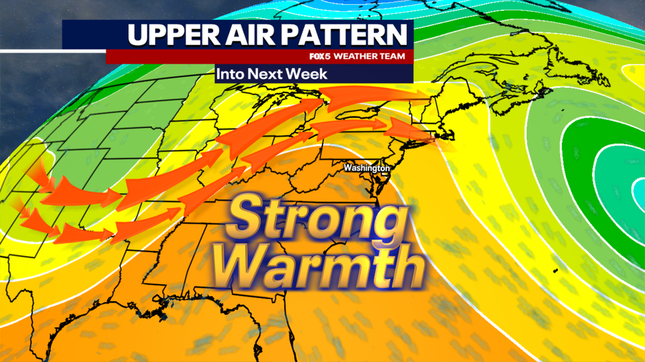
The cause? A strong ridge of high pressure will dominate the American Southeast starting on Sunday and growing in intensity through the early workweek.
These ridges are stubborn and often slow-moving, allowing for a prolonged warm air outbreak across our region.
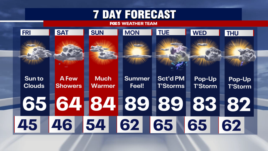
During the peak of the heat on Monday and Tuesday, parts of our region could see high temperatures reach the lower 90s, which would put it in record territory.
Monday's record high for Washington, D.C. is 91°, set back in the very hot spring of 2017.
That was also the last time D.C. saw temperatures in the 90s during April.
Last year, D.C. did not see its first 90° day until early June!

DC weather: Temperatures could reach 90 degrees with threat of thunderstorms next week
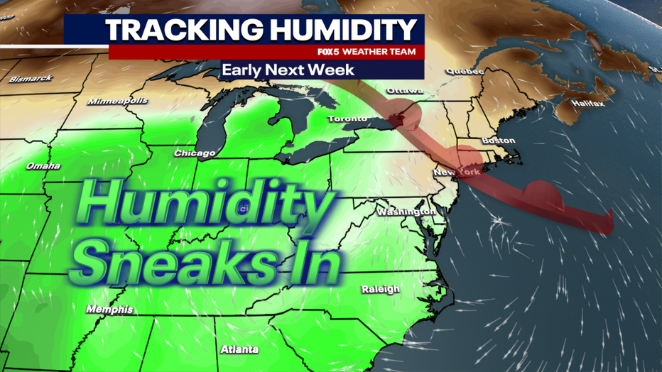
It is not just the heat that will be making it feel a little more like summertime either, but a touch of humidity as well.
By Tuesday, dew points could rise well into the 60s ahead of a cold front that will cross the region. Combined with the heat, this will make it feel more like a late June or July day in our region. So make sure you have some plans to keep cool. It is not a bad time of year to check on your air conditioners and make sure they are ready to go ahead of the real summer heat in the months ahead! Area splash parks, such as down at The Wharf, are likely to be popular cool spots to check out early next week.
DC weather: Temperatures could reach 90 degrees with threat of thunderstorms next week
Now, with the summer-like heat and humidity will come the threat of some summertime thunderstorms as well.
A weak cold front will cross the area on Tuesday, and while it will not lead to drastically cooler temperatures, it will come with some enhanced jet stream energy, which could power the threat of some stronger thunderstorms in our region on Tuesday afternoon and evening.
DC weather: Temperatures could reach 90 degrees with threat of thunderstorms next week
It is a little too far in advance to know the specifics on how widespread the threat will be, just know it is a day that the FOX 5 Weather Team is closely monitoring.
Beyond Tuesday, the lower to middle 80s look likely to stick around the remainder of the week, with the next cooldown coming around next weekend, although it only looks like it will knock us back into the 70s. Stay cool!