DC winter storm threats: Snow chances, arctic blast in 2025
A strong dip in the jet stream could enhance D.C.’s risk for winter weather towards the middle of the month.
WASHINGTON - The D.C. area will start 2025 off with two chances for winter weather as a cold front moves in over New Year's Eve and a second storm system moves into the area the first weekend of the year.
A look back at 2024
It kicked off with a January that brought us about 8" of snow over the course of about five days, but was then followed by the third-warmest spring on record for the city. This was then followed by the third-hottest summer on record for our region, and then the second-warmest fall on record. This was coupled with the longest stretch of dry weather in D.C. history, with 38 straight days without rainfall in D.C. between early October and the middle of November.
All together, even with the colder-than-normal December to close out the year, 2024 is still expected to go in the books as the warmest year in D.C. history overall.
READ MORE: DC snow: Several inches possible Sunday into Monday
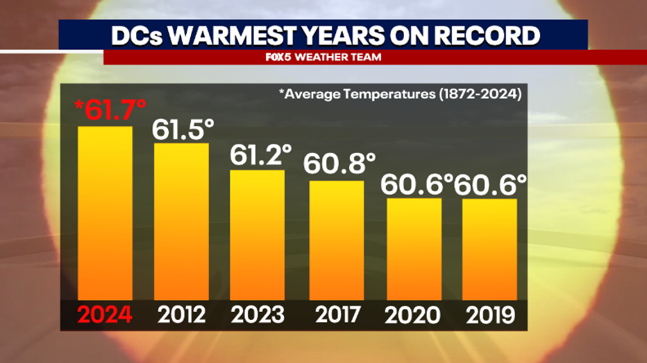
2024 was D.C.'s warmest year on record at an average of 61.7 degrees.
Looking ahead to 2025
So what do we have to look forward to as we enter 2025?
Well, one thing you will notice from a lot of weather folks is that guarantees are hard to come by. There is a lot of chance of this or chance of that. So, when a weather person offers a guarantee, you can bet that they are quite confident in what they’re predicting.
The guarantee that I can give is that the first half of January (at least) is going to be cold, and that there is likely going to be a burst of strong cold later next week.
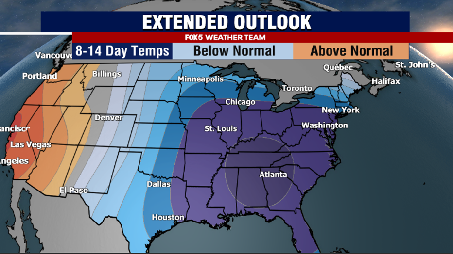
This weather graphic shows an extended outlook of low temperatures for much of the Southeast and Mid-Atlantic.
That’s about where the guarantees end, at least for now. But, of course, when you hear about a long-duration cold event in the month of January, one question has to pop up in your mind … will there be any snow?
Well, while we cannot offer any guarantees when it comes to snow, we can tell you it does appear to be one of the better weather patterns in recent years for getting some snow to fall in the D.C. region.
December 31, 2024 – January 1, 2025
The first time period we are watching is actually right around the corner, New Year’s Eve!
As we get ready to bring in 2025, a weak storm will be passing towards our Northwest. For the immediate D.C. region, this storm is not likely to be more than some rain showers, as temperatures will be too mild. It could bring several inches of snowfall to our mountain zones to the west, as well as the Great Lakes and interior Northeast.
This storm will usher out the brief mild wave we wrapped December on, and bring in colder temperatures into the first day of the New Year.
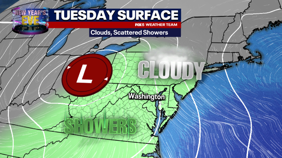
This weather graphic shows clouds and scattered showers for the D.C. area on Tuesday, December 31.
January 5-6, 2025
The second system we are watching in this active pattern comes ashore in the Pacific Northwest sometime around Friday, January 3 and pushes eastward towards our region by January 5- 6. This storm is a tricky one. We are going to be early in a cold pattern, but the initial cold air is not as strong as what will be coming along later next week. The pattern is one that also suggests that the storm would be more favored to pass just to the northwest of the D.C. region, cutting up the Appalachian Mountains.
While these typically favor rain, there will be a cold air mass in place, so depending on the timing of the system, it does suggest this second one could end up being more of a mixed bag of precipitation, perhaps a snow to rain transition, or some sort of wintry mix threat. Yet still, if the cold is dug in a little stronger than forecast and blocking patterns establish themselves a little faster than expected, this wave could sneak to our south and end us as more of a snowmaker than anticipated.
This is certainly a period we will be watching closely, and one where we’ll have to hammer out the details as we get into later this week.
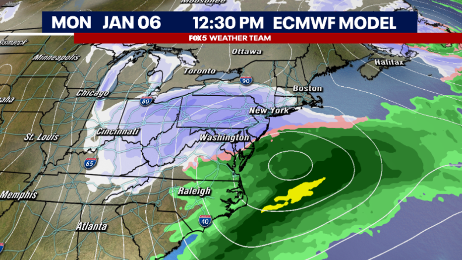
This weather graphic shows an ECMWF Model of increase precipitation off the coast of the Mid-Atlantic on January 6.
January 7-11, 2025
Regardless of what path the second storm ends up taking, even colder air will spill into the Mid-Atlantic region behind it. This may set the stage for the third wave, which initial models suggest may come our way sometime between January 7-11.
With the colder air entrenched farther south, and strong model support for Canadian and Arctic atmospheric blocking patterns to be aligned in a way that traps it there, a third system may develop near the Gulf of Mexico and push northward up the East Coast. Should all of these things happen, this third wave would be the storm most likely to bring us a more impactful snowfall.
Now, of course, we are making predictions for something that is about a week and a half away, but this article would not be mentioning it if there was no strong ensemble support for the potential for a storm in this timeframe.
It is a period that bears watching, and one that could end up being our best shot for meaningful winter weather this entire winter. We will continue to update you on this time period, as the models get a better handle on what this time period may bring over the next week or so.
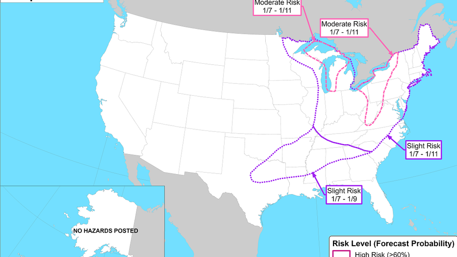
Much of the east coast is under a slight risk of heavy snow the second weekend of January, according to NOAA.
What is a cross-polar flow?
Behind this third wave, it is quite possible that the coldest air of the entire winter season spills into the eastern half of the country. There is strong model support for what we call cross-polar flow where air is transported from Siberia across the polar region and right into the contiguous states. The strongest cold seems most likely between January 10-14…with lingering cold looking likely beyond this time period, quite possibly through the Martin Luther King Jr. holiday weekend and Inauguration Day.
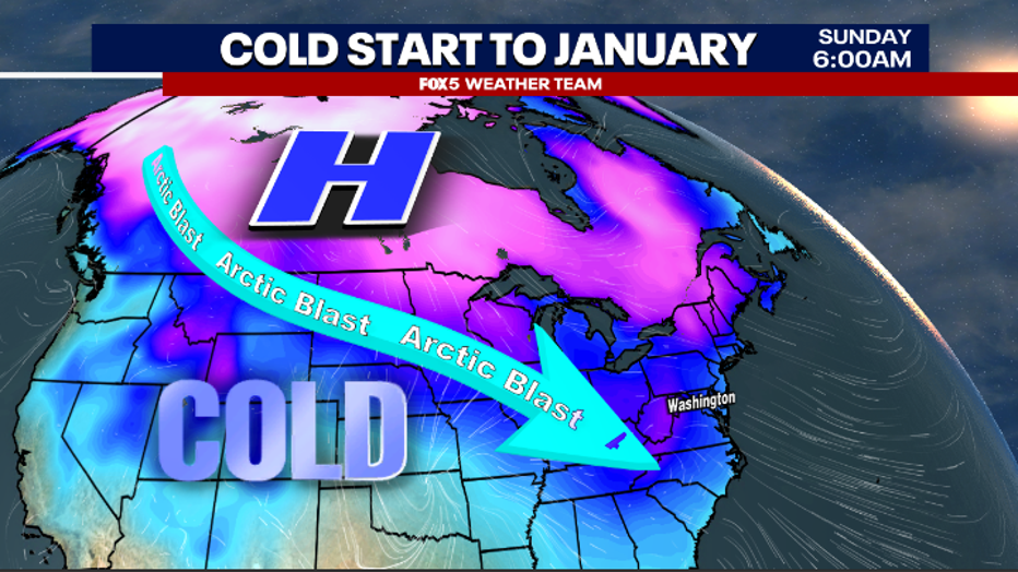
This weather graphic shows an arctic blast from the north bringing cold air to the Mid-Atlantic.
The FOX 5 Weather Team will continue to closely monitor these threats as we head into the New Year. Download FOX Local for a live update from FOX 5 Weather Team Thursday at 7:30 p.m. and for live weather alerts all winter long. Here's how.

