DC weather: Why didn't we get more snow in DC area?
Why didn't the DC area see more snow?
FOX 5's Gwen Tolbart breaks down what changed overnight in the potential for snow in the D.C. area.
WASHINGTON - Washington, D.C., Maryland, and Virginia was expecting to see widespread snowfall overnight into Saturday, but with warmer temperatures than expected, the snow did not stick.
Although up to six inches was expected north and west, some of those areas saw only two to three inches – and other parts of the DMV saw less.
By Saturday morning, the quick-moving clipper system left the D.C. area heading north, with heavier snow bands hitting Pennsylvania and New Jersey with more snowfall.
The rest of Saturday, expect gusty winds and mostly sunny skies with wind chills. Saturday night, temperatures are expected to drop with lows in the 20s, meaning any untreated wet surfaces could mean slippery, hazardous conditions for Sunday.
Next week, expect President's Day to arrive with mostly sunny skies and temperatures in the upper 40's to low 50's. The rest of the week expect sunshine and a warming trend through the middle of the week ahead of a chance for rain Thursday and Friday.
Weather forecast for Saturday, February 17
By Saturday morning, a quick-moving clipper system left the D.C. area heading north, with heavier snow bands hitting Pennsylvania and New Jersey with more snowfall.
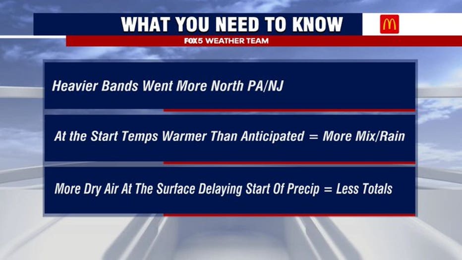
Why didn't D.C. get more snow?
Heavier bands of snow hit north of the DMV, to parts of north Pennsylvania and New Jersey.
The start of precipitation was delayed Saturday night, thanks to more dry air at the surface. When precipitation did start to fall Saturday night, temperatures were warmer than anticipated, leading to more of a wintry mix and rain for most areas.
"The duration of the event was shorter than anticipated, and that is the primary reason that amounts came in under," said FOX 5 Meteorologist Mike Thomas. "They got snow down into the northern neck and southern Maryland. But because it was shorter lived than anticipated, they didn't get the forecast amounts down there."
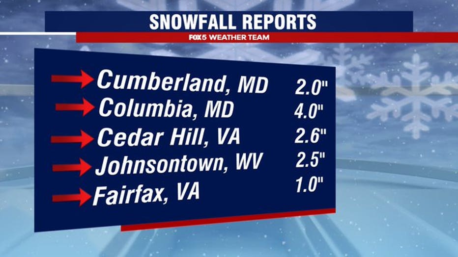
How much snow did the D.C. area get?
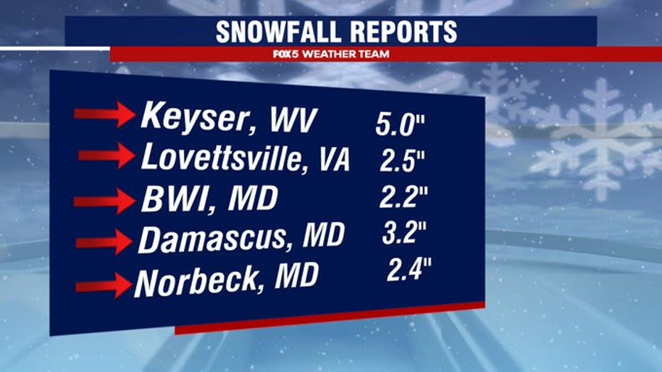
Parts of Maryland and West Virginia saw over two inches, according to the National Weather Service. Closer to the D.C. metro area, Fairfax only saw one inch of snowfall.