DC winter snow storm: Timing, how much to expect by Monday
5 to 9 inches of snow, Winter Storm Warning starts 10pm Sunday
FOX 5's Gwen Tolbart has the latest forecast as a winter storm threatens to bring as much as 9 inches of snow overnight into Monday.
WASHINGTON - A storm system is expected to move through the Plains and Midwest this weekend, potentially bringing our most meaningful snowfall in years.
UPDATE: Click here for the latest forecast for how much snow and snowfall timing, hour by hour on Monday for D.C., Virginia and Maryland.
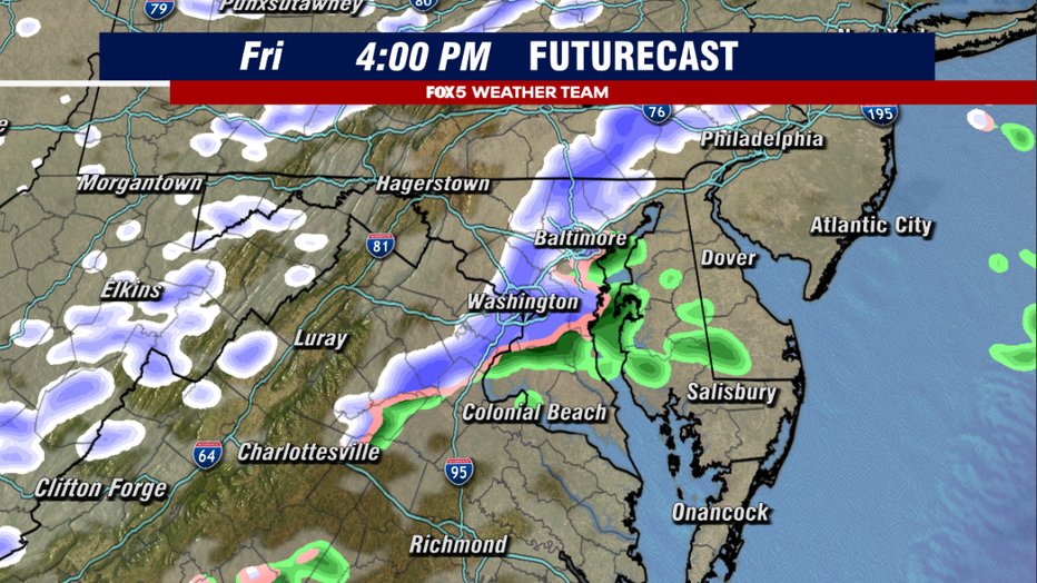
A Weather Model Shows The Threat For Snow Showers and Snow Squalls in the DC Region on Friday Afternoon.
What to expect Friday?
On Friday, a powerful cold front will sweep the region during the afternoon. This is the leading edge of some much colder air that will be heading into the D.C. region ahead of the weekend. High temperatures will go from being seasonable for early January in the lower to middle 40s, to high temperatures only in the lower to middle 30s through the weekend. Overnight low temperatures will plummet as well, with overnight lows falling back into the teens and 20s for both Saturday and Sunday mornings.
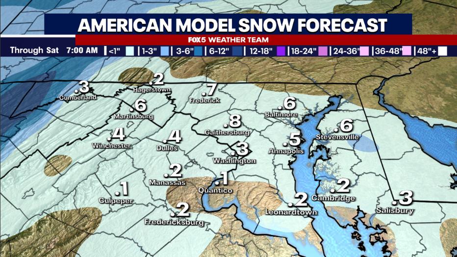
Weather Model Shows The Threat For A Light Coating Of Snow On Friday Afternoon.
The big story of the weekend is the cold. The vast majority of the weekend will be dry, with clouds battling sunshine from time to time and temperatures struggling to make it far above freezing each afternoon. The cold is key, because it is what we call "preparing the ground for snow" by the end of the weekend. By cooling the ground temperature below freezing across the region through the weekend, this means that once the snow starts falling it should stick almost immediately instead of losing some to initial snow melt. The snow could start falling as early as Sunday night across the D.C. region.
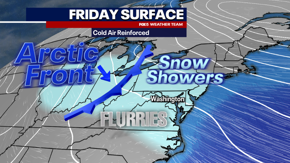
Cold Air Will Be Reinforced Friday As A Powerful Cold Front Sweeps The Region
What is a snow squall?
Models are suggesting a period of widespread snow showers and the potential for snow squalls as it passes through the region. Sometimes referred to as "mini blizzards"...a snow squall is a brief but intense period of snowfall that can reduce visibility and lead to a quick coating to an inch or more of snow in a very short period of time. They tend to move on as quickly as they begin. They are a hazard to travelers though as roads can quickly become snow covered as they roll through, though they tend to clear quickly after they pass.
Most weather models are showing this as being a threat at this time, though no weather models show heavy amounts of snow on the ground, most do show the threat for a quick coating to an inch or so across much of the D.C. area. While it is not expected to be a long-lasting impact event, it is important that folks understand that as these snow showers cross over the D.C. region they could come down briefly heavy. Most squalls last only about 20-30 minutes however, and end as quickly as they begin. Cold and dry air behind the front should cause skies to rapidly clear Friday night, and temperatures will plummet into the weekend.
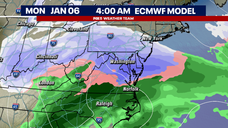
The European Weather Model forecasting snowfall across the DC region early Monday morning.
When will the snow start in D.C.?
Computer weather model guidance does differ on the timing of exactly when the snow will start to fall in the D.C. region, but the weather team is leaning towards a start on Sunday night, possibly sometime after 6:00 p.m. The exact timing should come into view in the days ahead. Snow is expected to be heaviest during the overnight and early morning hours of Monday.
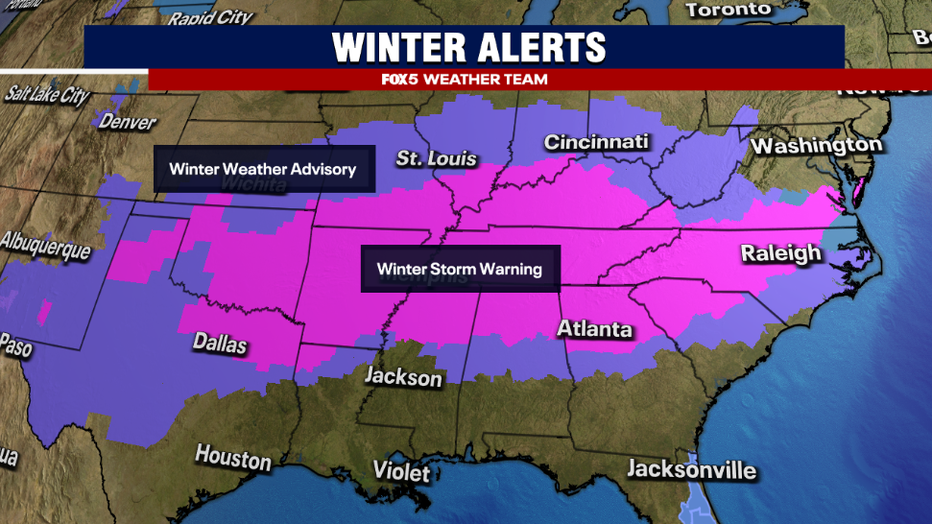
Forecast Calling For A Cold, But Mostly Dry Weekend In DC, With Snow Starting Later Sunday Night
Will schools close on Monday?
Next week is supposed to be when most of the region heads back to school and work after the holiday vacation period comes to an end. Assuming the forecast holds however, it is very likely that students across our region may add an additional day or two to their vacations given the timing of this storm system.
Find the latest school closings here.
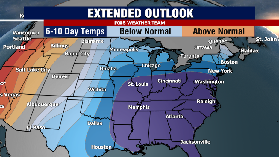
Forecasts Show High Probability of Cold across the Eastern United States through Mid-January
How much snow is expected? DC, Virginia, Maryland forecast
The latest forecast from National Weather Service shows a widespread eight to twelve inches of snow possible across much of the D.C. region, with locally more possible. Areas south of D.C. will have a better chance of a mix of snow, sleet, and freezing rain.
Temperatures are expected to remain in the low 30s and 20s. The wind chill across the D.C. region is looming in the 10s.
According to the FOX 5 Weather Team, heavy snow is expected Monday morning which will drastically impact traffic and travel.

Graphic from the National Weather Service showing expected totals of 8" to 12" for most of the D.C. area
When was the last time D.C. saw a snowstorm?
It has three years since the Washington, D.C. metro region was last impacted by a storm that brought over half a foot of snow. On January 3, 2022 a post-New Year's snowstorm blanketed most of the D.C. region in four to eight inches of snowfall, with parts of southern Maryland picking up over a foot of snow. The storm famously shut down I-95 in Virginia, stranding some motorist on the highway for over 24 hours.
The FOX 5 Weather Team has been closely monitoring the forecast progression of the storm system moving towards the D.C. region this weekend, which may be our most meaningful snowfall since that system three years ago.
The FOX 5 Weather Team will continue to provide update on this storm in the days ahead, and will continue to refine timing and snowfall totals as well. We should have a good idea of what we are expecting across our region by Saturday. Regardless of how much snow does fall, confidence is high on a period of very cold air settling in across the eastern half of the country behind this system. It could end being our coldest period of the entire winter. Whether or not more snow risks will show up within this cold period remains to be seen, but lets focus on one system at a time.
Stay Ahead of winter weather on FOX Local, with live exclusive updates every day at 7:30 p.m. ahead of this storm system. Here's how to watch FOX Local on your smart TV and on the go.
The Source: This story includes reporting from FOX 5 meteorologist Mike Thomas.

