

DC snow forecast: Could DMV see more winter weather next week?

DC snow forecast: Could DMV see more winter weather next week?
Another blast of winter weather could be moving in our direction. FOX 5’s Tucker Barnes has the latest look at the models which show the potential for a snow threat next week.
It's been quite the winter this year. La Niña did finally emerge, but it was late at the onset and remains very weak so far through February.
DC's coldest winter in years
Other factors have been driving this winter so far, and they have kept the pattern both cold and active for most of it.
As a result, since the start of meteorological winter back on December 1st, 2024, this continues to run as D.C.'s coldest winter in six years.
The winter of 2018-19 has, so far, been about a degree colder than our current winter. Rather fittingly, that was also the last time D.C. had a winter with more snowfall than our current winter.
We picked up 16.9" of snowfall that winter.
How much snow has fallen in D.C. this year?
So far this winter, 14.8" of snow has fallen. Of that, 6.4" came with this recent February snowfall – already making this D.C.'s snowiest February in a decade.
Could we add to that total next week though?
Will it snow in DC next week?
Whether we could see snow later next week actually begins with what happens this weekend.
A powerful storm system will traverse the eastern half of the country Saturday through Sunday.
While some of our mountain zones to the west could start and end this storm with some snow, the immediate D.C. area is just looking at rain for this event this weekend.
For travelers through the holiday weekend though, watch out for some heavier snowfall across the interior Northeast as this storm pushes north.
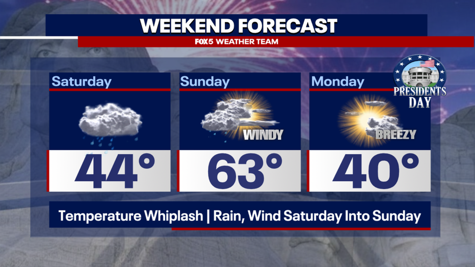
For the D.C. area, in addition to the rain, the winds from this storm are expected to be quite gusty, especially on Sunday and Monday.
These winds will cause a bit of a temperature whiplash across the D.C. region.
Temperatures could rise from the 40s on Saturday, to the lower to middle 60s on Sunday, before collapsing back to the 30s and 40s heading into Presidents' Day.
As this storm travels northward, it will displace a lot of cold air that is currently bottled up in southern Canada.
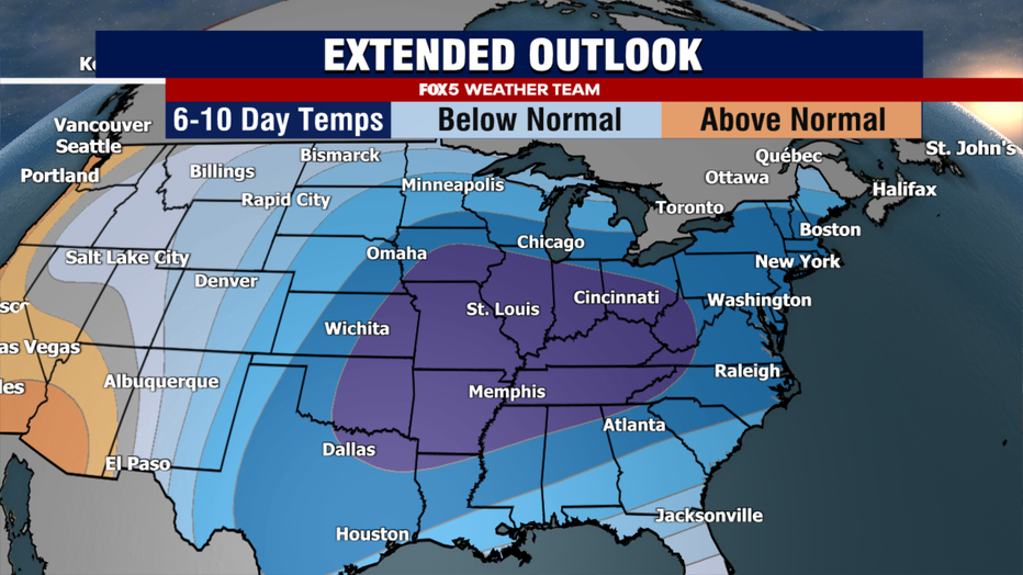
Arctic air, polar vortex headed toward DC
This strong push of arctic air will plunge southward across the eastern half of the country through the front half of next week.
An upper level feature known as a polar vortex will help power this outbreak, which could be the strongest cold in our region since the middle of January. Many will not make it out of the 30s through the middle of next week.
It is towards the middle of next week that things will get interesting.
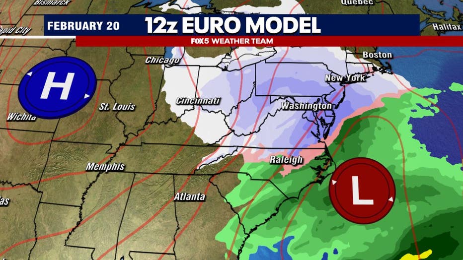
Various weather models have been showing for several days now the potential for another snow threat in the Mid-Atlantic and Northeast centered around Wednesday-Thursday of next week.
As we are so far out in the forecast period, the details are not known yet about exactly what this system could bring, but temperatures do appear cold enough that if a storm was to form, it would likely be a winter threat to the D.C. region yet again.
Now, several times this winter, we have seen the threat of snow a week away end up fading as the event gets closer.
However, the early signs with this one are looking pretty promising for some type of threat in the east next week.
Stay with the FOX 5 Weather Team for the latest forecast updates as this active winter pattern continues for our region. The FOX LOCAL app is your source for live FOX 5 DC weather updates. Click here to download.
The Source: FOX 5 Weather Team