Blizzard Warning: Foot of snow possible for beaches as bomb cyclone blasts Northeast
FOX 5 Weather forecast for Friday, January 28
Tucker Barnes has the FOX 5 Weather forecast for Friday, January 28
WASHINGTON - It has been nearly 2200 days since the last blizzard in Washington, DC…the 2016 blizzard that dropped more than 3 feet of snow on parts of our region. It had been four years since the beaches were under blizzard warnings, since a storm in early January 2018 brought over a foot.
Maryland prepares for winter weather
Maryland's State Highway Administration Assistant Media Relations Manager Shanteé Felix joined us with a check in ahead of Friday’s winter weather.
While DC's streak continues this morning, places like Ocean City, MD (and NJ) as well as Rehoboth and Bethany Beach, DE were all placed under blizzard warnings this morning as a powerful bomb cyclone is expected to hammer the coastlines of the Mid-Atlantic and Northeast.
A foot of snow will be possible for area beaches, while up near Boston, up to three feet of snow will be possible.
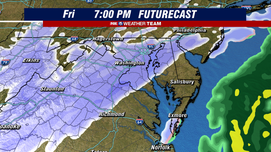
The event is likely to start as scattered light snow between the hours of 3-6pm tonight as an arctic front drops into our region. The snow will be the light and dry variety, not the heavy and wet variety that we have seen in recent events.
This is because temperatures will be rapidly cooling through the mid-levels of the atmosphere throughout the evening hours tonight.
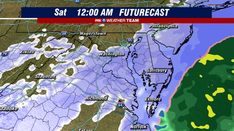
As the front progresses eastward, it will start to interact with more ambient moisture thanks to a developing coastal system off the Carolina coastline. Beyond sunset tonight is when snow is likely to be most expansive around the I-95 and eastern areas.
Rehoboth Beach prepares for snow
Rehoboth Beach Public Works Director Kevin Williams joined us to discuss the winter storm heading to the region.
With ground temperatures pretty cold after several days of below normal temperatures in the region, the snow is likely to lie even though it will be of the lighter variety. While there could be an isolated heavier batch of snow in the region this evening, the I-95 is a little bit too far from the main system to expect any sort of heavy snowfall rates with this event, which is why we are anticipating lighter totals locally.
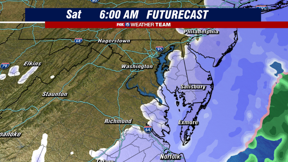
By the early overnight hours, snow should wrap up here in DC. The beaches and eastern shore will continue to see moderate to heavy snows straight through the overnight hours though, as the coastal storm gathers strength and pushes northward.
Once the storm wraps up, it will wrap down some very gusty winds, and very cold air throughout the rest of the day on Saturday.
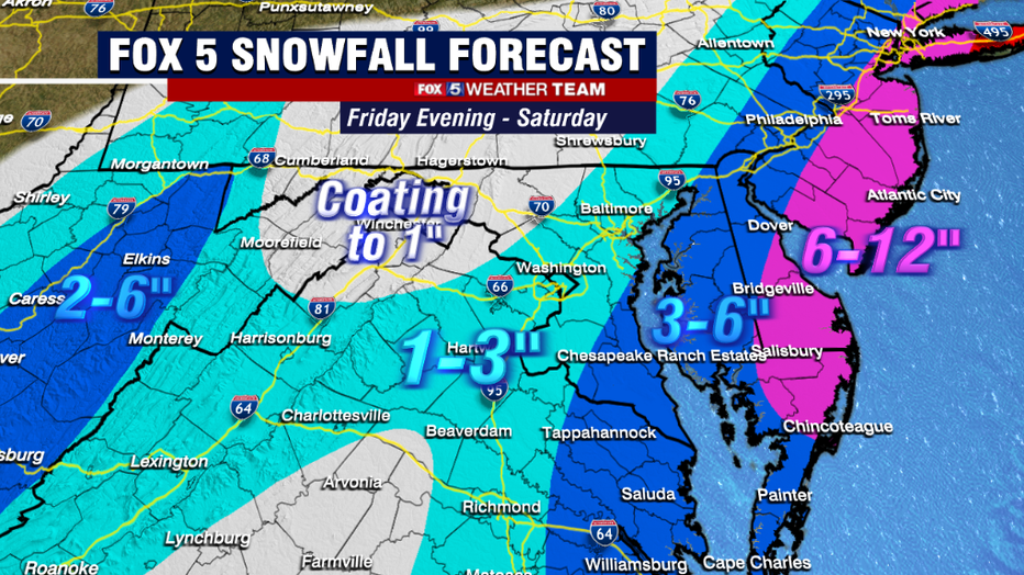
As for expected totals, the lighter snow rates should lead to lesser totals around the I-95 corridor, as we're only forecasting a general 1-3" of snow. DC, Baltimore, and the I-95 corridor in between were all added to winter weather advisories Northwest of town, dry air mixing in with the moisture field should lead to even less snow up that way.
Highest totals will be southern Maryland and the Eastern Shore, as they are likely to get into some of the banding from the developing coastal system. The beaches will be hit the hardest, where up to a foot of snow will be possible.
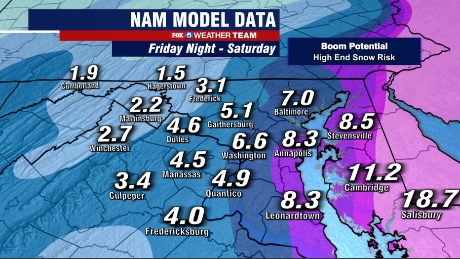
What about if things do not go according to plan though? This morning's North American Mesoscale model, commonly known as the NAM, shows a possible "boom" scenario. The biggest difference between this model and some others is that it is the farthest west with the track of the coastal snowstorm.
This brings the heavy bands from the snow storm all the way back to the I-95 during the overnight hours tonight, allowing for about half a foot in DC. While this is not the favored solution, it does show how things could turn out if the storm takes more of a "surprise" western track.
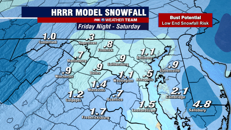
On the other side of side, we have a few models showing a potential "bust" scenario. This morning's run of the High Resolution Rapid Refresh model, commonly known as the HRRR, does not like this storm one put.
It has too much dry air handing on around the DC region, and tracks the storm too far off the coastline so that even the Eastern Shore and the beaches get a lot less snow than expected. Just like the "boom" scenario, this is not the expected outcome, but remains a risk to the forecast should the storm underpreform.
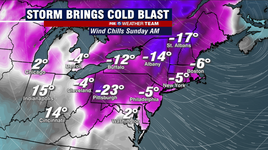
As things currently stand, the storm is expected to move out pretty quickly on Saturday morning. As it does, skies will begin to clear, but then another aspect of this storm will take hold. As the storm pushes up near New York and New England, it will begin to rapidly strengthen, a process we call bombogenesis. This strengthening will "supercharge" the winds across our region, with gusts between 30-50mph possible on Saturday afternoon through Sunday morning.
This is strong enough that we can not rule out the threat for some power outages across the area this weekend, especially given the weaker tree limbs this time of year. Combined with temperatures in the teens and 20s on Saturday night, wind chills could easily drop into the low single digits, or even to subzero levels. That's dangerous levels of cold, so make sure you are dressing appropriately if you plan to be out an about this weekend.
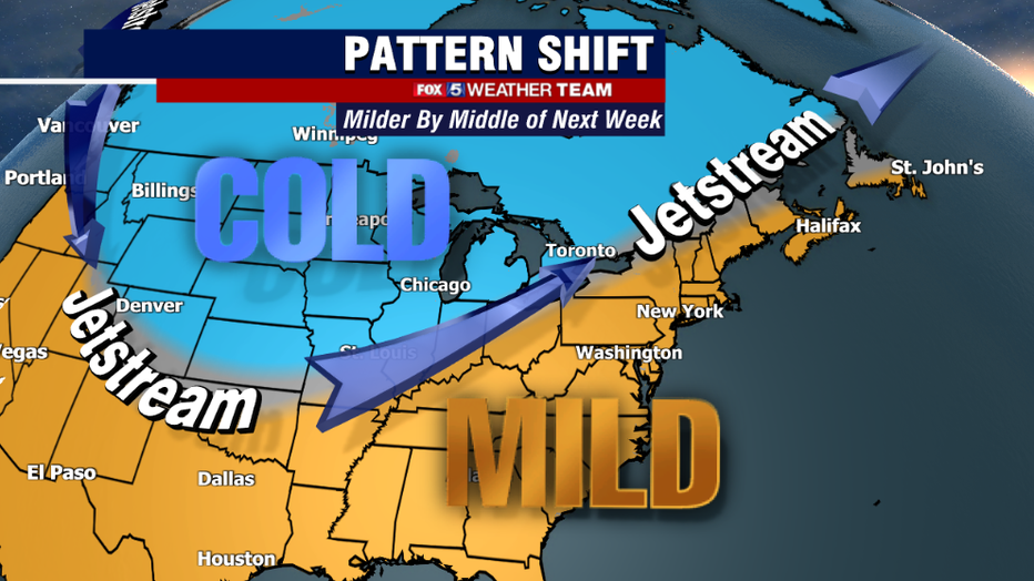
To end with a bit of a light at the end of the tunnel…a bit of a warm-up still looks likely by the middle part of next week. While the warm-up may come with some rain…much needed to wash the salt off my car…the is the potential for the first 60s in our region in about a month around the next Wednesday/Thursday time frame. It does look like we turn cold again into next weekend though. But any break from the cold, will be a welcome one.

