

BLIZZAPOINTMENT: Why snow struggled in the DC region last night
Less snow than expected: What went wrong
FOX 5's Jen Delgado walks through what happened overnight to keep snowfall totals lower than expected.
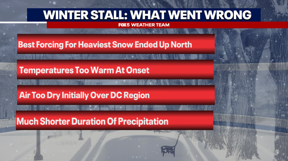
WASHINGTON - Hindsight is 20-20 is how the phrase goes, though looking back at the event from overnight in the D.C. area, the signs that things were going wrong appeared very late in the forecast period. Often called "now-casting," it became clear when the snow finally did begin to fall that this event was not going to go as planned. So what went wrong?
Mild, But Dry Air
Many immediately point to the fact that temperatures were too warm at the onset. While yes, this did play a role, not in the way you might think. Temperatures were always expected to be well above freezing at the start of this event. That was not a surprise. Temperatures just a couple of thousand feet above the surface region wide were well into the 20s however, and this is why snow was still expected. What was more unexpected was just how dry this air mass would be.
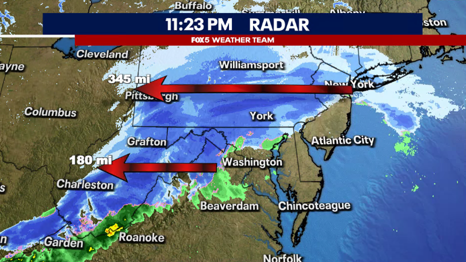
What forecasters call a dew point depression, or the difference between the air temperature and the dew point, is key to a snow event like this one. We expected it and needed it to be dry. The reason why is that when you precipitate into a dry air mass, you evaporate the moisture into the airmass, cooling it. What we call evaporation cooling. Radar data indicates that above surface precipitation began even over the DC metro between 9-10pm Friday night. However, because of the dryness of the air, it did not start reaching the ground until after the midnight hour. That’s two to three hours of precipitation that we missed out on. Which played a major role in the end.
Snowfall Rates
We mentioned several times on air and online that the key to this event was snowfall rates. The National Weather Service in their discussion mentioned the threat of 1-3" per hour snowfall rates. These rates were expected to last a minimum of two to three hours, which would have quickly given most of the area a quick 2-3" of snow at least. While parts of our region did see some of these bands kick up around 2:00 a.m., they were much more localized than expected.
This largely had to do with what was happening in the upper levels of the atmosphere. A feature known as a mid-level jet across northern Virginia was much weaker than computer guidance suggested it would be. Without this additional upward enhancement that the jet was supposed to provide, the rates began to fail, a mini-domino effect occurred. Without the heavy precipitation feeding into the dry air mass, the cooling was not nearly as rapid as expected. So it took longer to moisten and cool the atmosphere, and once it did enough for snow to reach the surface, it was slightly warmer than forecast and much lighter than forecast, all a recipe for an underperforming snow event.
Shorter Duration
Despite everything mentioned above, the storm did eventually dynamically do what it was expected to do. The lower atmosphere cooled. Snow rates picked up. Snow was falling from the sky as far south as Fredericksburg, Southern Maryland, and parts of the Northern Neck. However, then we had a new problem to contend with. By the time the event had "caught up" to what was expected to happen in the first place...it was already almost over.
While rates never exceeded 2" per hour locally, we did get into some bands that exceeded 1" per hour for a period of time...but it was a short period of time. The heaviest snows started to fall around 2:00 a.m., but not long after 3:00 a.m., the event was already wrapping up. Most guidance suggested that the event would last until closer to 5:00 a.m., with heavy snow falling between 1:00 a.m. and 3:00 a.m. With just an hour of heavy snowfall to account for, this spelled disaster for the higher forecast totals.
Why didn't the DC area see more snow?
FOX 5's Gwen Tolbart breaks down what changed overnight in the potential for snow in the D.C. area.
So like we began, hindsight is 20-20. While FOX 5 DC does not issue the watches and warnings (those come from the National Weather Service) winter storm warnings were never needed for much of our region outside of the mountains. It was a combination of factors that led to this being the first snow forecast this year that was a significant bust. Now as we get later into the season, the question becomes, will this be our last accumulating snow of the season? Only time will tell, but at the moment the pattern is not looking all that great for snowfall as we get beyond the Presidents’ Day holiday.
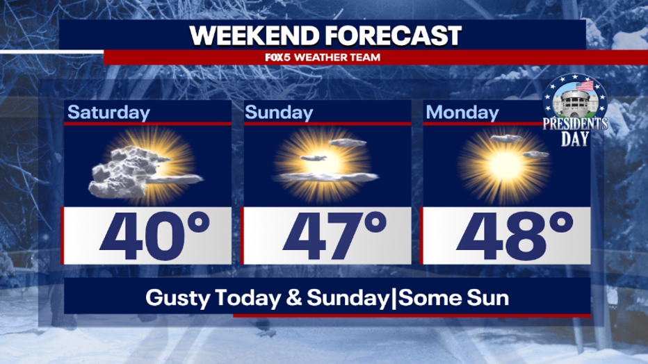
One thing that we did mention from the beginning was that regardless of how much snow we do get, it would not last very long as the remainder of the weekend forecast features more sunshine and temperatures well above freezing each afternoon.
Enjoy the rest of your Presidents’ Day weekend! We will continue to keep you up to date with the latest when the next storm, whether rain or snow, comes our way.