

Winter wraps up with severe weather threats, temps in the 70s
WASHINGTON - The final weekend of winter is here, before the Spring Equinox arrives next Thursday, though in many parts of the country it will feel much more like spring than winter to close out the season.
At long last, winter is coming to an end.
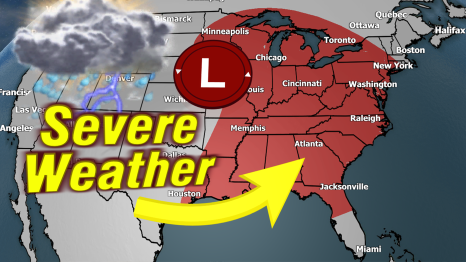
Unfortunately, that also means the potential for spring threats. The National Weather Service is warning of a potential widespread severe weather threat heading through the upcoming weekend across the eastern United States.

DC weather: Cool temperatures with cloudy skies
FOX 5's Tucker Barnes has your weather forecast for Friday, March 14.
Friday: Western Midwest & South
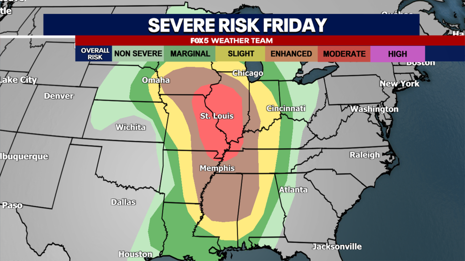
This morning, the National Weather Service, Storm Prediction Center...or SPC for short...placed much of the western Midwest and South under an enhanced risk for strong to severe thunderstorms, with an even greater moderate risk issued for parts of Illinois, Iowa, Missouri, Kentucky, and Tennesse.
This is the second-highest alert level that the SPC issues, with only a rarely issued high risk zone being a level higher. While the tornado threat is elevated for these regions on Friday afternoon and evening, the SPC notes that they are primarily concerned with widespread damaging wind gusts embedded within a line of severe thunderstorms. The SPC says that "wind gusts of 70- 90mph appear possible" and the threat of "baseball-sized hail" exists as well.
Saturday: Deep South
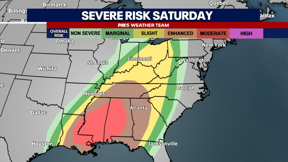
The severe threat moves eastward on Saturday, as a strong cold front approaches the Gulf region, tapping into stronger moisture for thunderstorm development. A feature known as a low-level jet will develop across the South as well, enhancing low-level wind shear — the changing of wind speed and direction with height through the atmosphere — across the region.
This could lead to a much more widespread tornado outbreak, particularly across parts of Louisiana, Mississippi, and Alabama. The SPC placed these regions under a moderate risk this morning, noting that "numerous significant tornadoes are possible on Saturday afternoon and evening" in the region.
Saturday in DC: Can Spring Warmth Win Out?
While the South battles with severe weather, the DC region will have a fight of our own on Saturday, though ours is more related to temperatures. Highs across the DC area fell into the 50s on Thursday afternoon, with more 50s expected for the day on Friday. This is courtesy of a feature known as a "cold wedge."
A cold wedge is what happens when surface winds out of the northeast trap cooler air near the surface. This is a feature that is somewhat unique to the Mid-Atlantic and Northeast, because of our elevation and vicinity to the Appalachian Mountains.
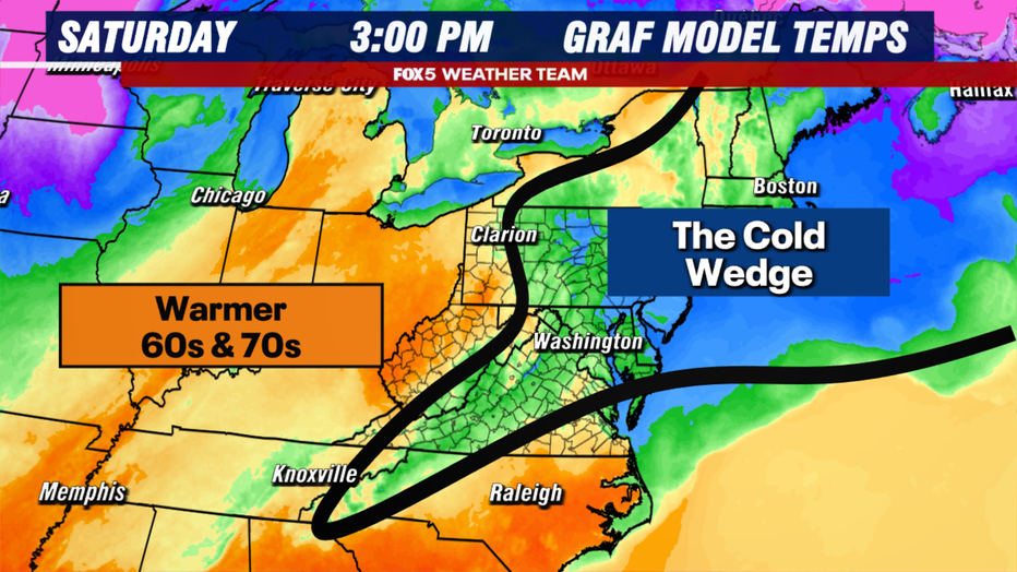
Winds that come in out of the east are forced to turn southward when they hit the mountain range, trapping cold air at the surface. As warm air tries to come in, it will often be pushed up and over this colder, heavier air. This can lead to widespread cloud cover, and often, in the spring, widespread fog, mist, and drizzle. These are all threats to the DC region. Saturday could end up being much cooler than expected.
Sunday: Severe Weather Shifts East
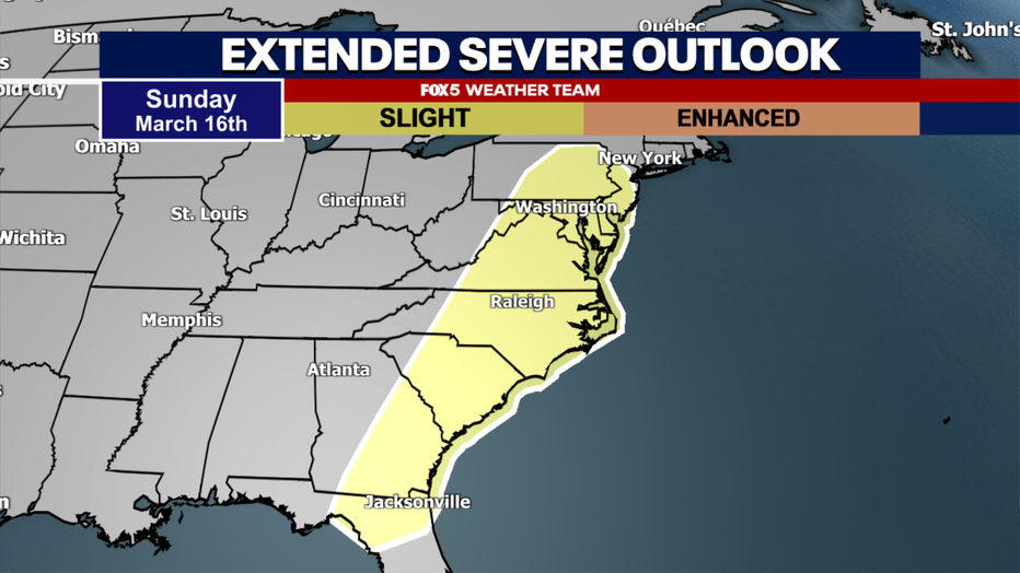
By Sunday, stronger southern winds will most certainly erode the cold wedge, sending temperatures across the DC region well into the 60s and 70s. The day will start mostly cloudy to partly sunny, but much of the first half of the day will be dry. The question is: how much sunshine can we work in during the first half of the day?
Should we stay cloudy all day, and high temperatures stay mostly in the upper 60s to about 70°F, the severe weather threat later in the day will be more limited. If we are able to break into any decent sunshine, and temperatures jump into the middle to upper 70s, the threat of more severe weather will be higher.
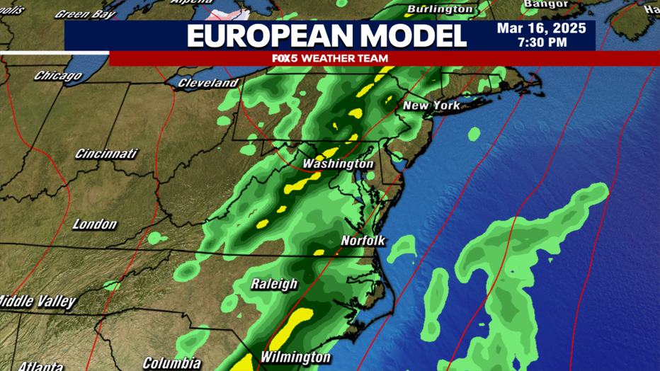
A strong cold front will approach the region during the late afternoon and early evening hours of Sunday, bringing with it the threat of a period of heavy thunderstorms with the potential for some severe weather. The SPC has had our region at a level 2 of 5 with slight risk of severe weather during this timeframe.
While we will not have the same forcing and wind shear present over our region on Sunday as will be on Saturday in the South, limiting our tornado threat, the risk is still there that some of these storms could pack a punch with damaging winds.
Model guidance has suggested that storms will come through in a line, embedded within could be some gusty thunderstorms. While it is unlikely that the entire region will see severe weather, the threat of scattered severe thunderstorms knocking down trees and powerlines is a concern that we will continue to monitor.
Next Week: Spring Returns
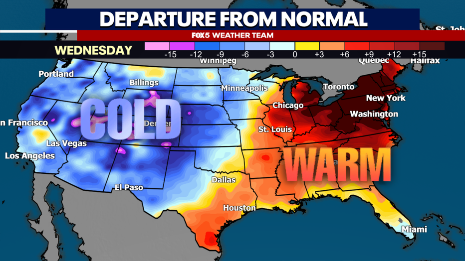
While St. Patrick’s Day on Monday may be a little cooler behind the cold front, with most of the region looking at 50s and lower 60s. Temperatures will quickly rebound heading through the last couple of days of winter. We are anticipating sunshine and much more widespread middle to upper 60s on Tuesday, with 70s making a comeback by Wednesday afternoon.
Early thoughts on the first day of Spring next Thursday do indicate more clouds and the potential for some spring showers, but temperatures should still be quite mild in the upper 60s to lower 70s.
The FOX 5 Weather Team will continue to monitor the threat for severe weather throughout the days ahead, and keep you up to date on the latest!