

Hurricane Milton: Florida evacuation map helps visitors and residents find nearest exit route
TALLAHASSEE, Fla. - As Hurricane Milton intensifies to a Category 3 storm, Florida is bracing for potentially the largest evacuation since 2017 - and the Know Your Zone map is available to help find out if you are in an evacuation zone.
The state's evacuation zones span across waterways and hundreds of miles of coastline, affecting millions of residents.
READ MORE: Milton latest: Hurricane expected to intensify to Category 4 before Florida landfall
In past hurricanes, mass evacuations have led to significant road congestion, with hours-long backups and delays as residents sought higher ground.
The interactive map, created by the Florida Department of Emergency Management, helps residents and visitors determine if their homes or businesses fall within evacuation zones and identify the nearest exit routes.
These routes are designed to guide residents to safer areas, away from coastal threats.
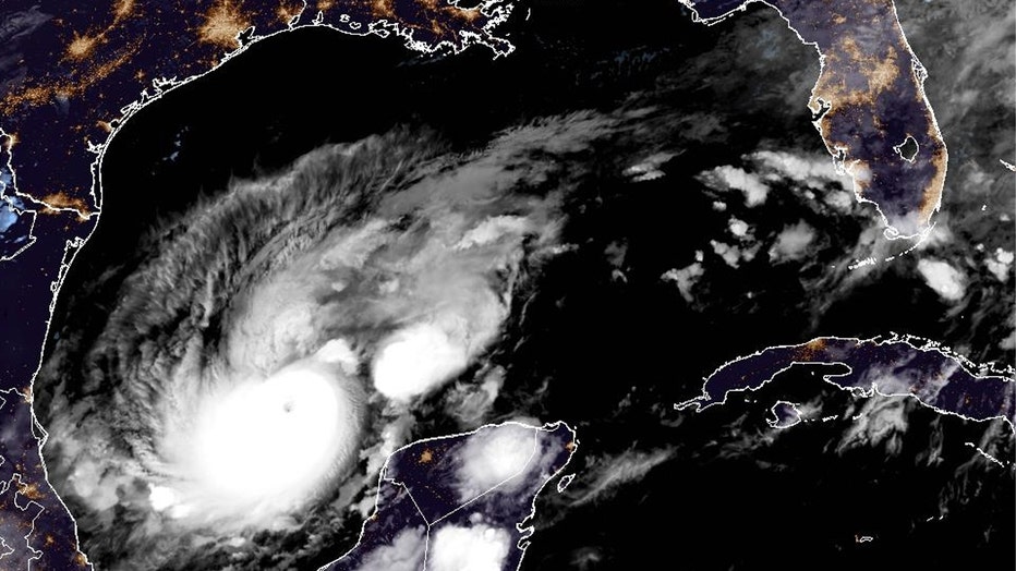
A GeoColor image of Hurricane Milton in the Gulf of Mexico on Monday, October 7, 2024. (National Oceanic and Atmospheric Administration / NOAA)
Forecast models vary widely, but the most likely path for Hurricane Milton suggests it could make landfall Wednesday in the Tampa Bay area.
Milton is expected to remain a hurricane as it crosses central Florida into the Atlantic Ocean.
This trajectory would largely spare southeastern states already devastated by Hurricane Helene, which caused catastrophic damage from Florida to the Appalachian Mountains, with a death toll rising to at least 230 as of Sunday.
READ MORE: FEMA doesn’t have enough funding to last through hurricane season, Mayorkas warns
The Associated Press contributed to this report.