DC sees warmest November in history ahead of frigid December
November is about to close out as the warmest on record in D.C. history.
Meteorological fall, which runs from the first of September through the November 30, will also finish as the top two warmest on record in the nation's capital. All of this following the third-warmest summer on record. 2024 has been a year for the record books – literally. Through this point in the year, 2024 has been the city's warmest on record.
That could very well change though, as the final month of year looks to start off on a very different note.
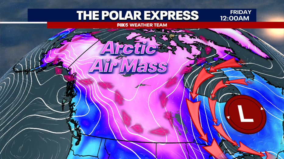
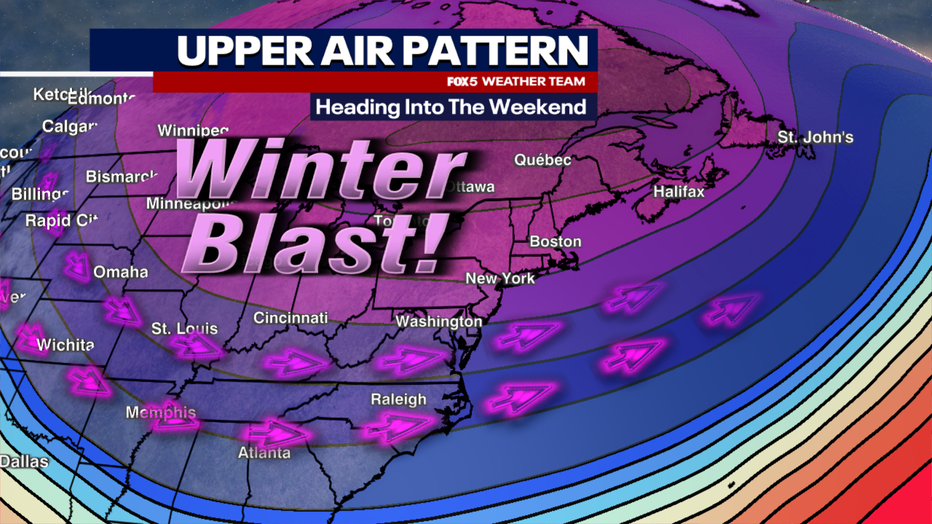
You have likely heard the term polar vortex a few times in recent years. Well, it does play a bit of a role here. The vortex is what we call stretched, elongated over the eastern half of the United States, opening the door for some stronger cold to dive southward. For the better part of the last week, cold air has been bottled up and strengthening near the southern edge of the Arctic Circle in northwest Canada. A strong wave of low pressure near the Hudson Bay will be dislodging some of this cold, and rotating it southward across much of the Midwest, Northeast, and us in the Mid-Atlantic in the days ahead. It will be a drastic change from the warmth we have enjoyed through the vast majority of the fall season.
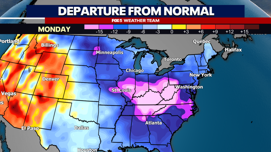
How strong is this cold? We're talking several days over the next two weeks where highs may struggle to make it into even the 40s. Overnight lows in the 20s, with some western suburbs likely to see teens as well. That's more typical of the month of January around the D.C. region – middle-of-winter-level cold. The model average temperature through the first ten days of the month of December is, at this time, just a hair over 37°. If this ends up being in the neighborhood, this very well could be the coldest start to the month of December since 2010, fourteen years ago.
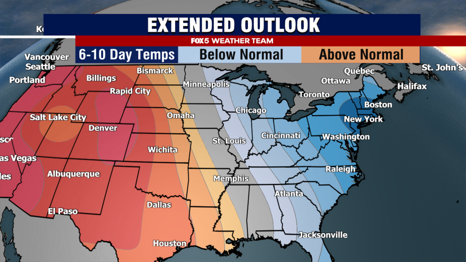
One of the more surprising aspects of this cold is not just how strong it is this early in the cold season, but also the longevity of it. The majority of what we call mid-range weather models, which are weather models that forecast the pattern out about two weeks in the future, are forecasting a sustained regime of below normal temperatures to continue through at least the middle of the month.
The reason? A strong, sustained ridge out in the western half of the county. This feature, known as a positive phase of the Pacific-North American Pattern, or +PNA for short, tends to sustain itself for two to four weeks, sometimes even longer. As long as this feature remains present, colder than normal temperatures will be favored across the eastern half of the country.
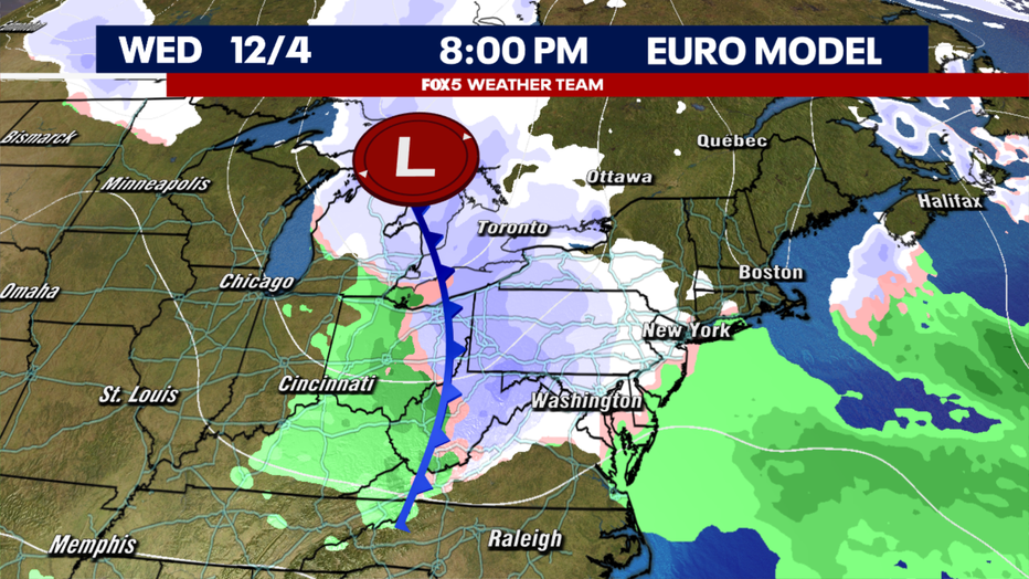
Of course, the question whenever we are talking about winter cold, is whether we are talking about any winter snow that comes along with it. In the short-term, the answer is not yet. The pattern is what we call a progressive pattern, very fast moving. So there is not a lot of time, so to speak, for storms to come together and get organized. Energy is being moved too quickly in the jetstream.
Speaking of the jetstream, the way it is structured across the eastern half of the country is also not the best for big snowfall potential in the DC area...at least not initially. Now, that does not mean that snow is impossible.
Strong flow off the Great Lakes, which remain mild and unfrozen this early in the season, can occasionally bring down some snow showers or flurries. In addition, fast-moving but weak storm systems called clippers are possible in this type of a cold pattern. Several weather models suggest one of these clippers may be possible during the middle of next week. Though it is still far to early to know if it will have enough moisture to possibly put down any light accumulating snow for our region.
As we look beyond, the pattern does suggest that there could be a little bit more of an active pattern towards the middle of December, but it is still far too early to see if all the pieces will come together for perhaps more meaningful snow. The Fox 5 Weather Team will continue to keep you updated on any winter threat that pop up in the weeks ahead. Have a wonderful weekend and stay warm!

